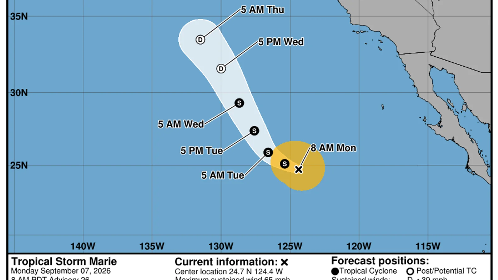
Marie at 15:00 UTC
Tropical Storm Marie was centred near 24.7°N, 124.4°W at 15:00 UTC on Monday, 7 September, well west of Baja California. The National Hurricane Center estimated maximum sustained winds at 55 knots, or about 100 km/h, with gusts to 65 knots. The storm was moving west-northwest at 6 knots and had an estimated central pressure of 988 hPa.
The centre was moving away from land, but that does not make the ocean harmless. The official high-seas bulletin described tropical-storm-force winds extending well beyond the centre and significant seas reaching 8 metres in part of the circulation. Swell can travel away from a cyclone and create rough surf and dangerous currents at beaches even when the sky nearby looks ordinary.
A weakening forecast
The forecast advisory expected Marie to continue west-northwest before turning more northwest. Maximum winds were forecast to fall to 45 knots by 00:00 UTC Tuesday and 40 knots by 12:00 UTC. The longer-range forecast showed Marie becoming a post-tropical remnant low by Thursday.
Weakening is a trend, not an instant switch. Wind and wave conditions can remain hazardous after the cyclone loses its tropical-storm classification. Mariners should use the latest high-seas forecast, while beach visitors should follow local lifeguards and coastal advisories.
How to read the cone
The white cone on the official graphic shows the probable area for the future centre of Marie. It does not show the width of tropical-storm-force winds or the reach of swell. The centre can also move outside the cone. A coastline outside the cone may still experience dangerous surf.
For the same reason, the letters along the forecast track are not a timetable for conditions at a beach. They describe the forecast classification of the centre at selected times. Local effects depend on the size of the circulation, the direction of swell and the shape of the coast.
What changes would matter
The next advisories will show whether Marie weakens on schedule and whether its northwest turn begins as forecast. A slower weakening trend could keep stronger winds and higher seas in place for longer. A change in track could alter where the largest swell travels.
This report records advisory number 26. Before making marine or coastal decisions, open the newest National Hurricane Center product and check the issue time. A normal city forecast is not a replacement for official tropical cyclone and coastal hazard information.