The forecast in plain language
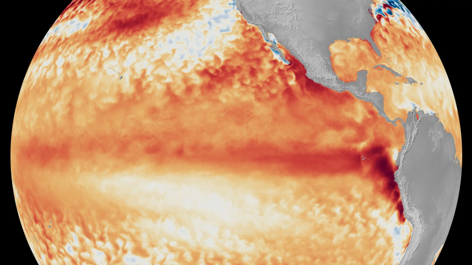
El Niño is firmly established and is likely to become very strong before reaching its peak toward the end of 2026, according to the World Meteorological Organization's update published on 3 September. WMO's multi-model forecast put the probability that El Niño will persist through both September–November 2026 and December 2026–February 2027 at nearly 100%.
That probability describes the continuation of the large-scale ocean–atmosphere pattern. It is not a 100% forecast of a particular flood, drought, heatwave or storm. Seasonal forecasts shift the odds of broad temperature and rainfall patterns; they do not specify the weather on a particular street months in advance.
The distinction is central to using the outlook responsibly. A strong climate signal can improve preparedness, but local decisions still depend on forecasts and warnings from the national meteorological service responsible for that location.
What scientists are seeing in the Pacific
WMO said the widely used Niño 3.4 sea-surface temperature index averaged 1.5°C above normal from May through July and reached 2.0°C above normal in July. Weekly readings from late July to mid-August were approximately 2.2°C to 2.6°C above average. In some parts of the tropical Pacific, subsurface temperatures were more than 8°C above average during July and early August.
Those numbers do not all measure the same layer or time period, so they should not be collapsed into one temperature. Together with atmospheric signals and agreement among seasonal prediction systems, WMO treats them as evidence that the coupled El Niño pattern is continuing to intensify.
NOAA describes El Niño as the warm phase of the El Niño–Southern Oscillation, or ENSO. Changes in tropical Pacific ocean temperatures and winds alter where heat and moisture enter the atmosphere. That can shift pressure systems, winds and rainfall far from the equatorial Pacific.
Very strong does not mean identical impacts everywhere
WMO explicitly cautions that the strength of El Niño alone does not determine the severity of its effects in an individual country. Location, season and other climate drivers matter. Conditions in the Indian and Atlantic Oceans can reinforce, weaken or redirect patterns that might otherwise be associated with El Niño.
For September through November 2026, WMO's multi-model outlook favours above-normal temperatures across almost all land areas. Its rainfall outlook shows a more recognisable El Niño response, but a seasonal colour on a global map is still probabilistic. It does not say that every day will be hot or that every point inside a wetter-than-normal area will flood.
A seasonal rainfall signal can arise from changes in how often rain occurs, how intense events become or where storm tracks settle. Local terrain, soil moisture, rivers, urban drainage and exposure then shape what that rain means on the ground.
What the outlook does not prove about recent disasters
The timing of the WMO announcement overlaps with destructive floods and other weather emergencies in several regions. That overlap is not enough to attribute an individual event to El Niño. Establishing why a particular flood became extreme requires event-specific meteorology and, for a formal attribution claim, dedicated analysis.
It is therefore inaccurate to label every flood, drought or tropical cyclone in late 2026 as an El Niño disaster. El Niño changes background probabilities and circulation patterns. Individual events still have their own weather setup, and some regional outcomes can run against the typical pattern.
The same care applies to tropical cyclones. ENSO can influence wind shear and the distribution of cyclone activity between ocean basins, but it does not create a simple rule for the track or intensity of one named storm. Official cyclone advisories remain the source for immediate decisions.
What to watch through early 2027
The next WMO and national updates will show whether ocean and atmospheric indicators keep strengthening, when the event peaks and how quickly it begins to weaken. The most useful local information will come from regional climate outlooks and national meteorological and hydrological services, which can combine the global signal with conditions closer to home.
For households, the practical message is not to predict a specific disaster from the El Niño label. Check seasonal guidance for planning, then switch to medium-range forecasts and official warnings as an event approaches. Farmers, water managers, health services and emergency agencies use the longer lead time differently because their exposure and decision windows are different.
This report reflects WMO information available on 9 September 2026. The nearly 100% figure refers to persistence through the stated seasonal periods, while the forecast of very strong intensity and a late-2026 peak remains an outlook that will be reassessed as new observations arrive.