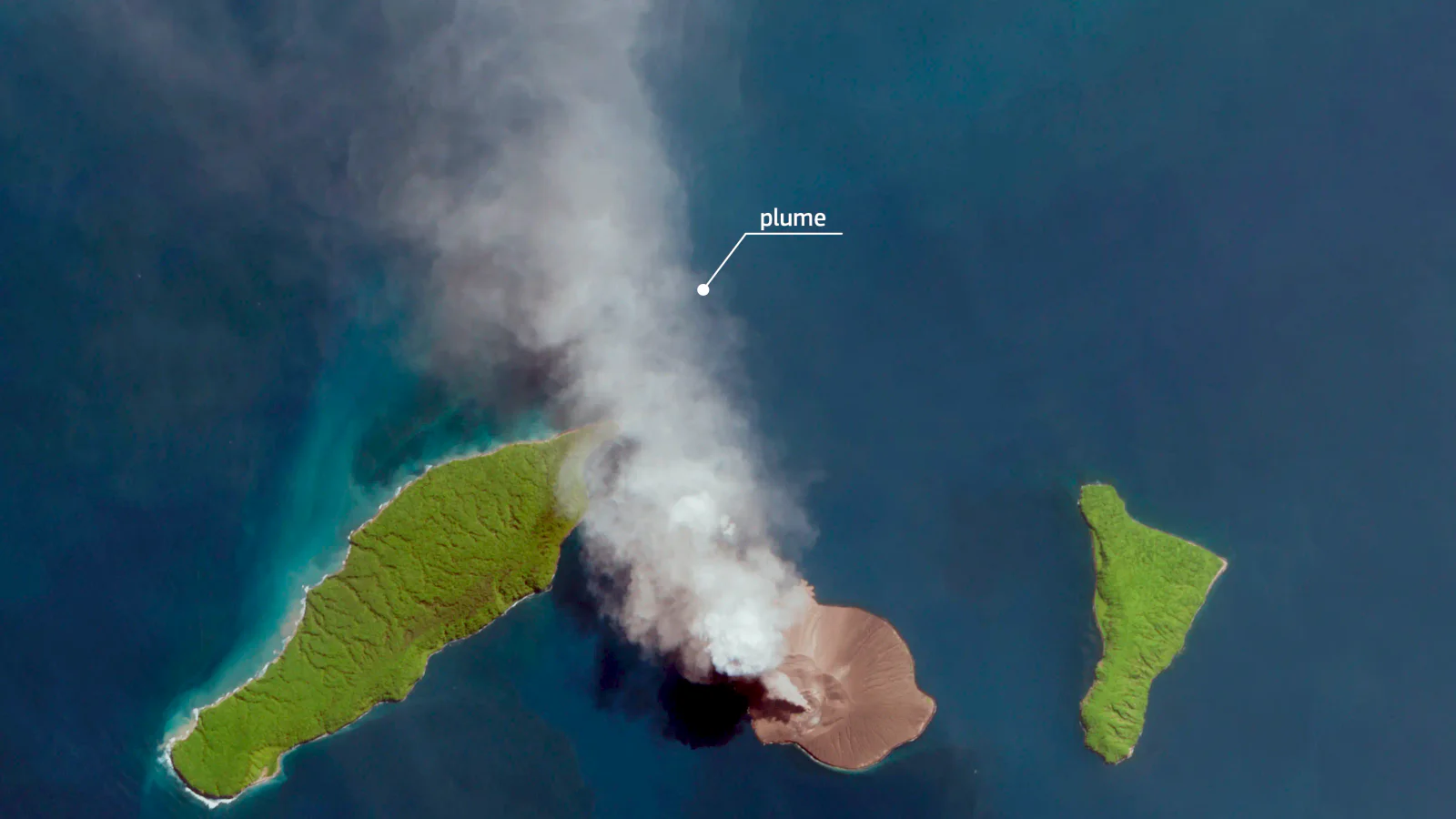
Status on Wednesday morning
Anak Krakatau remained at Level III, or Siaga, in Indonesia's four-level volcano alert system on Wednesday, 9 September. The official MAGMA Indonesia activity report covering 00:00 to 06:00 western Indonesian time said cloud obscured the volcano. A crater plume was not observed during that six-hour window, and winds were light to moderate toward the north-west.
That last detail needs careful reading. Not seeing a plume through cloud is not the same as confirming that the eruptive episode has ended. The alert level remained unchanged, and the Center for Volcanology and Geological Hazard Mitigation, PVMBG, continues to publish monitoring reports through MAGMA Indonesia.
The volcano sits in the Sunda Strait between Java and Sumatra. It has produced repeated eruptions since early July. The latest episode became a national transport story after ash travelled far beyond the immediate area and reached airspace used by airports around Jakarta, Banten, West Java and Lampung.
Why the airport numbers look different
Reports published as the disruption unfolded carry different totals because they refer to different cut-off times and count different things. Tagesschau reported on 6 September that 467 flights had been cancelled and more than 150,000 passengers were stranded, citing Indonesia's Transport Ministry through AFP.
Tempo's update the following morning said the eruption had affected eight airports, with 1,558 flights delayed or cancelled and about 170,000 passengers stranded. It reported that six airports remained closed early on 7 September, including Soekarno-Hatta and Halim Perdanakusuma.
Those figures should not be combined into one total. The later number includes delays as well as cancellations and covers a later stage of the disruption. They are operational snapshots, not final event statistics. Travellers should check a flight directly with the airline and airport because a reopened runway does not guarantee that an aircraft, crew or onward connection is in position.
What authorities said about the ash
Tempo reported that Indonesia's BMKG weather agency used PVMBG and Darwin Volcanic Ash Advisory Center information together with Himawari-9 satellite imagery to identify two areas of ash dispersion early on 6 September. One extended toward Jakarta, Banten and West Java from the surface to about 20,000 feet. A higher plume, reported on the Sumatra side, reached about 50,000 feet.
Volcanic ash is a serious aviation hazard. Fine particles can reduce visibility and damage aircraft systems, including jet engines, which is why authorities can close airspace even when communities far from the crater do not see heavy ashfall at ground level. Wind changes can also move the affected corridor between successive observations.
The disruption was therefore wider than the exclusion area around the island. Tagesschau and Tempo both reported a three-kilometre restricted zone around Anak Krakatau for vessels. That distance describes an immediate access restriction; it is not the outer edge of possible airborne ash.
Tsunami reporting needs precision
Indonesia's disaster and geological authorities said this eruptive sequence did not present an imminent tsunami threat in their updates quoted on 6 and 7 September. That assessment was specific to the activity being monitored at the time. It should not be rewritten as a permanent statement that Anak Krakatau cannot generate a tsunami.
The distinction matters because a sector collapse at Anak Krakatau triggered a deadly tsunami in 2018. Current hazard decisions belong to Indonesia's monitoring agencies, which can change the alert level or recommended zones as the volcano changes.
Advice for residents and travellers
Tagesschau reported that BNPB advised people affected by ashfall to use masks and eye protection, reduce outdoor activity and take care while driving. Local authorities may issue more specific instructions for schools, ports and communities.
For a flight, use the airline's own status page and the departure airport, not an old list of closures copied into social media. For the volcano, follow PVMBG/MAGMA reports and observe the official exclusion zone. For coastal safety, follow BMKG and local disaster-management instructions rather than trying to infer tsunami risk from the size of an ash cloud.
This report was checked against the MAGMA activity page on 9 September. Visibility at the volcano was limited during the cited morning period, and conditions can change after publication.